
Today we can look at the Nile, its temples, and the ancient monuments that line its banks from Abu Simbel to Alexandria, and from everything we know, easily see the chakra layout as in the human body. And that brings us to ask a question that has no clean answer: how much of what we’re seeing was planned as one thing, rather than many separate things built across centuries?
Some say the ancients may even have been able to see from one temple roofline to the next, creating a continuous visual and symbolic thread along the river. Whether that’s literal or symbolic, it reflects a striking strategic and defensive logic – a civilisation thinking not in single monuments, but in connecting lines.
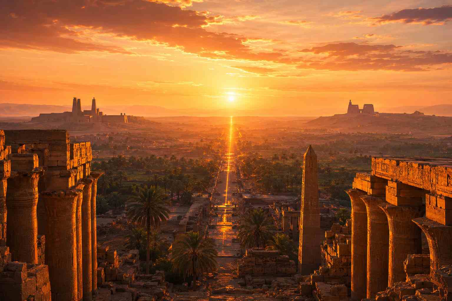
In Luxor, this sense of connection becomes especially clear. From certain vantage points, Karnak, Luxor Temple, and the Temple of Hatshepsut sit within the same living landscape, as if part of a deliberate conversation across space and time. Stand in the right spot at the right hour and the three of them stop feeling like three separate places you’ve visited, and start feeling like three points on a single sentence.
We can also read these sites through layers of meaning – linking them to chakra teachings, and even to astrological systems of thought. But when we remember the centuries that separate the construction of different temples, it becomes almost overwhelming to consider how coherent the larger pattern appears today.
What intelligence, inspiration, or guiding force shaped the vision of these rulers, priests, and builders?
Archaeological studies of Nile navigation and settlement patterns suggest that visibility, alignment, and river-line orientation were central to how ancient sites were chosen. Direct temple-to-temple visibility across the entire Nile is unlikely in a strict physical sense, given the distance, the haze, the topography. But many key temples were deliberately placed in intervisible clusters within regional zones, particularly in Upper Egypt. This creates a chain of local sightlines rather than one continuous line of sight – and that chain still points to something more deliberate than a random distribution of monuments along a river that happened to be useful.
And if there was a higher hand involved, then we are left with another question: how much did the builders themselves understand of the wider pattern they were contributing to? What felt like isolated acts of creation – a temple here, a shrine there, a generation apart – may now, in hindsight, form part of a much larger design that only becomes visible with time.
It also invites a reflection on our own lives. How much of what we build, create, or initiate may not yet show its meaning – or may never show it to us at all, but only to those who come after?
Is there a purpose, timing, and placement to everything we do that, as life designers, we cannot yet see, but are nonetheless part of shaping?
This question sits at the heart of one particular journey: a continuous overland route along the full length of the Nile, from the southern desert of Abu Simbel to the Mediterranean shore at Alexandria, travelling site by site through exactly the kind of sacred geography this piece describes. As we move physically along the river, we are also moving through layers of intention, legacy, and consequence – some visible, some still forming, and some only recognisable from a distance of time. It’s one thing to read about intervisible temple clusters and sightlines along a riverbank. It’s a different thing entirely to stand in the gap between two temples and feel, in your own body, why someone chose that exact spot three thousand years ago.
If that’s a question you’d rather stand inside than read about, the Sacred Journey along Egypt’s chakras follows this exact line, south to north, the long way – on the ground, not from a map.
Last updated on 21/06/2026 by Marie Vaughan